Local News
Southern Ontario blasted with significant snow in mid-week storm
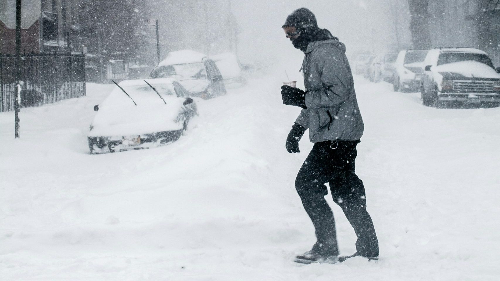
Southern Ontario experienced a potent, mid-week winter storm, with whiteout conditions worsening rapidly overnight into Thursday and up to 20 centimetres of snow confirmed in Toronto and the surrounding GTA.
There have been sweeping school bus cancellations and closures, leading to a treacherous morning commute for many on Thursday. Provincial police confirmed numerous collisions overnight, with vehicles stuck in snow drifts in Toronto and the GTA.
Track all school bus cancellations, school closures and other winter weather-related events here.
By the time the winter storm ends, the province will see between 15 and 35-plus cm of snowfall, with peak accumulation rates reaching 2 to 4 cm per hour. Winter storm warnings were issued for parts of the GTA and cottage country.
Environment Canada initially mentioned up to 20 cm of snow was possible in Toronto, with the heaviest snow falling overnight. The snow tapered off around 8 a.m., though northwest wind gusts of 40-60 km/h are forecast throughout the day.
Pearson Airport had recorded 23 cm of snow, making it the most substantial winter storm since March 2023.
The City of Toronto declared a significant weather event to prepare for the worst impacts on Thursday. Environment Canada eventually lifted its snowfall warning for Toronto this morning.
Vincent Sferrazza, the Director of Transportation Operations and Maintenance for the City of Toronto, said that planning and strategy went as planned and started on Wednesday night on the DVP and Gardiner. Sferrazza noted that complete snow removal will begin on Monday, and some hot spots will be targeted on Friday.
Due to the snow storm, dozens of departing and arriving flights at Toronto Pearson International Airport have been delayed or cancelled. Airport officials are advising travellers to check their flight status before leaving for the airport.
There could be more snow on the way
Toronto and GTA residents will get a temporary break on Friday, but another winter storm could impact the region over the weekend. A Colorado low is forecast to track just south of the area, bringing widespread snowfall to southern Ontario on Saturday.
Though subject to change, snow is forecasted to fall early Saturday morning, with 8 cm possible by the afternoon. An additional 5 to 10 cm of accumulations could be observed in the evening, and snow will continue overnight into Sunday.
It’s too early to determine the precise impact of the weekend snowstorm. Still, forecasters expect up to 20 cm of additional snow to fall in Toronto by Sunday, making Family Day weekend a challenging few travel days.
Saturday’s daytime high is forecasted to be -2 C, though it will feel closer to -5 with the wind chill in Toronto. It will be even colder in Toronto on Sunday, with a forecasted daytime high of -6 C, but it will feel more like -13.
Strong winds, lake-effect snow, and frigid wind chills will persist through Monday’s holiday. Click here to stay updated on province-wide weather alerts.
Visit here to sign up for the The Leader Spirit Weather Guarantee and to check out Toronto’s extended forecast.