Local News
High tides, low pressure, mean flooding likely along B.C.’s south coast
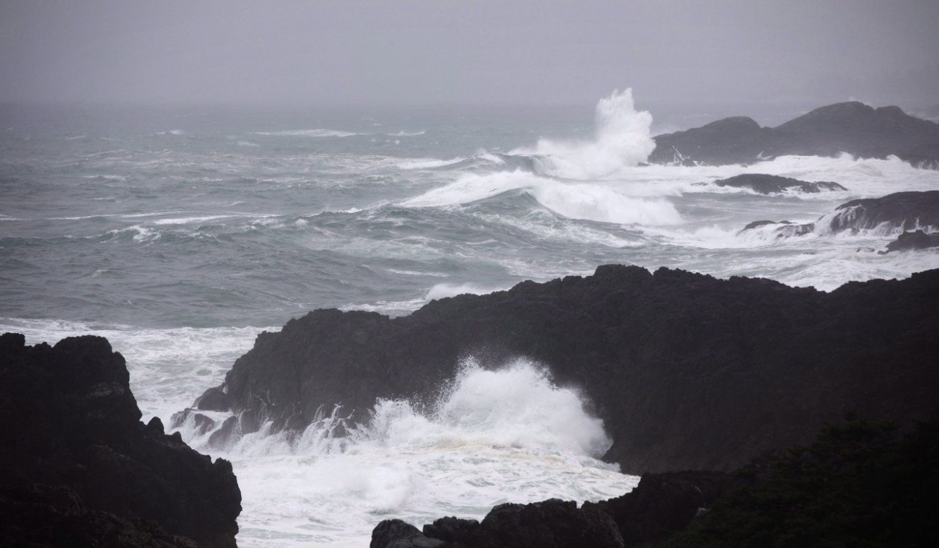
Environment Canada says high tides combined with a low pressure system have the potential to produce moderate flooding along parts of British Columbia’s south coast, including the Greater Victoria and Metro Vancouver areas.
A special weather statement from the agency says strong winds and waves are expected to push water levels above the highest astronomical tides this weekend.
The bulletin spans most of the Vancouver Island coastline, except the northern tip of the island, as well as Metro Vancouver and the Sunshine Coast.
It says the highest risk of flooding is expected Sunday.
The weather office says winds and surging waters can produce debris and cause erosion in coastal areas, where some flooding is likely along low-lying shorelines.
Avalanche Canada, meanwhile, says there is a high risk of slides across Metro Vancouver’s North Shore mountains and the Gibsons area, along with an area east of Prince George, while the risk is considerable between Squamish and Whistler.
The agency says the risk is also considerable, or level three out of five on its avalanche danger-rating scale, from the Nakusp area to mountains north of Prince George, along with an area north of Smithers in northwestern B.C.
In B.C.’s Interior, Environment Canada has lifted yellow-level freezing rain warnings that had been in effect for the Boundary, Similkameen and Fraser Canyon areas.
This report by The Canadian Press was first published Jan. 3, 2025.