Local News
Over 150 crashes reported as messy, stormy weather hits GTHA: OPP
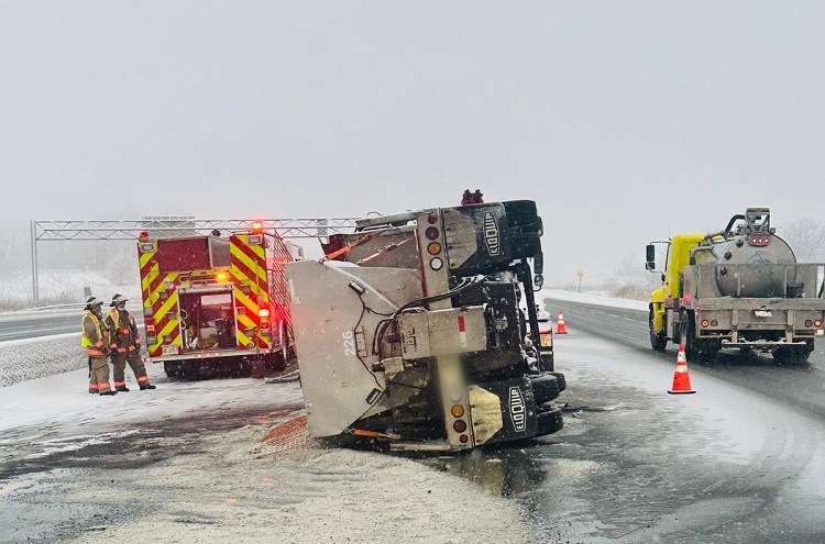
Over 150 crashes have been reported by Ontario Provincial Police (OPP) in the GTHA since early Wednesday morning as snow and rain fell across the region.
According to unofficial snowfall totals, 5-10 centimetres of snow blanketed Toronto before it mixed with rain near the lakeshore as temperatures increased.
But it’s not over yet. A cold front pushes through the GTA this evening which means winds will be picking up out of the north and temperatures will be dropping to -9 C overnight, with a wind chill near -17.

“Anything that’s wet out there has the potential to turn very icy in the next couple of hours,” said Meteorologist Natasha Ramsahai.
OPP say it was busy day for tow trucks and first responders and extended wait times for roadside assistance is expected. They recommend waiting until the weather system has passed before heading out on the road.
That north wind will also trigger some snow squalls north of the city starting Wednesday evening and continuing through Thursday. York Region will likely see the brunt of the squalls in the GTA with the possibility of more school bus cancellations.
Angus, Brandford and Innisfil are expected to be the hit the hardest with up to 50 centimetres of snow forecast for those areas. Newmarket could see an additional 20 to 35 centimetres.

“Ski hills are happy, Drivers will not be,” added Ramsahai.
Toronto could see the coldest air of the season this weekend. The daytime high on Sunday are forecast to be -6 C with an afternoon wind chill near -13. So far, the coldest daytime high of the season was just a couple of days ago on December 8. The high that day reached -3.3 C as measured at Pearson Airport.